
Scan-to-BIM Revit Model of Heritage Customs House, Auckland CBD, IFC and renders, floor plan and pointcloud fly-through
Summary
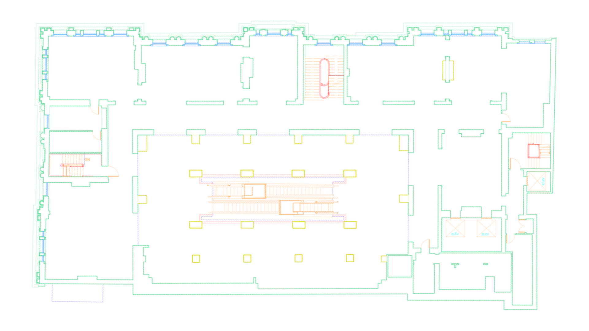
Meka Management needed an accurate, coordinated record of Customs House on the corner of Customs and Albert Streets in Auckland's CBD, one of the city's best-known heritage buildings. Recon tied the site into the LINZ survey network, laser scanned the building inside and out, and turned the point cloud into an LOD 300 Revit model with 2D plans, elevations and sections, plus a topographic survey of the street frontage. The result is a single, survey-accurate digital record of the building that the owner, designers and contractors can all work from.
Customs House
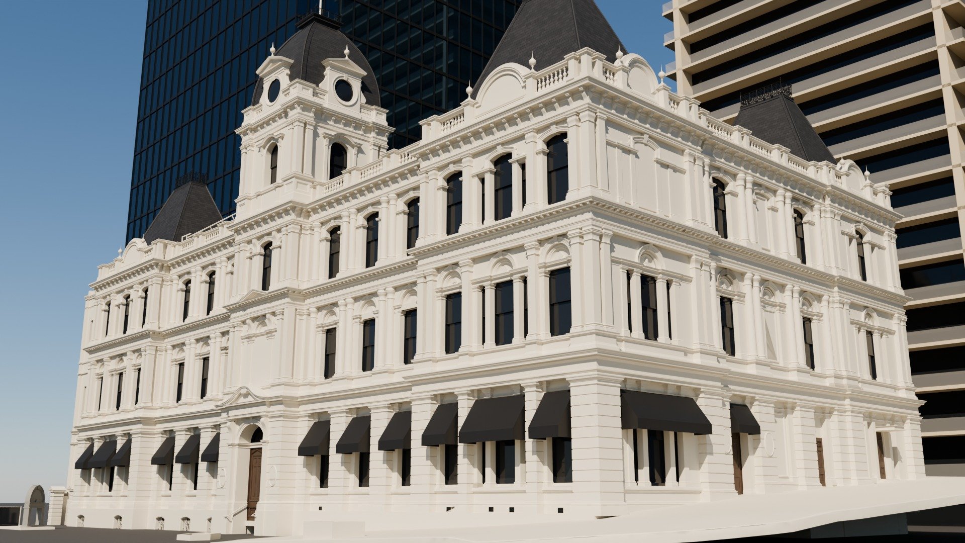
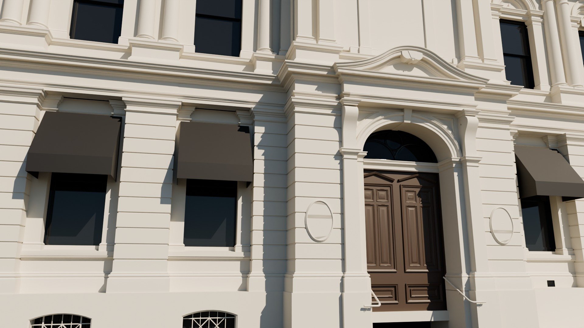
Customs House is one of central Auckland's landmark heritage buildings. Completed in the late 1880s for the Customs Department, its ornate masonry façades, tall windows and decorative detailing have survived more than a century of change around the waterfront.
Old buildings rarely match their original drawings. Walls aren't quite square, floor levels vary, and decades of fit-outs and alterations leave little reliable documentation. For a building like Customs House, guesswork isn't an option – any planning, maintenance or design work needs an accurate picture of the building as it stands today.
“Meka Management manages Customs House in-house, as we do across our portfolio. With most of the building vacant, we had an opportunity to consider its future use. The basic floor plans we’d inherited from previous tenants gave us very little to work with, so we commissioned the Revit model to give our architects and designers an accurate record of the building as it stands today.” – Peter Venter, Facilities & Project Manager, Meka Management
“Customs House is a large heritage building with several areas that are difficult to access. Given its age and scale, capturing that level of detail with traditional measurements would have been difficult. We wanted to give our design teams a reliable starting point and reduce uncertainty early, so laser scanning and a Revit model made sense for us.”
Survey Control and Topographic Survey
Recon started with a survey control network tied into the LINZ geodetic network. Surveyors brought control onto site and positioned scan targets (checkerboards) throughout the building, from the basement up through each floor. When the scans were processed, these targets fixed the point cloud in true position, height and orientation – so the scan data lines up with property boundaries, council drainage records and any future surveys of the site.
While surveying the scan control, the team also completed a topographic survey of the frontage from kerb to building, supplied as a DWG – giving designers the street levels and features at the building's edge in the same coordinate system as the scan.
3D Laser Scanning
With access arranged by Peter, Recon captured the building inside and out, from the basement to the roof, using FARO terrestrial laser scanners, which deliver point-to-point relative accuracy better than 2 mm. Two FARO scanners were run side by side, which completed the site work in about four days and kept time in the building to a minimum. The roof was also scanned with the FARO scanners, so no drone was needed as access was safe.
The scans were registered, quality-checked and aligned to the survey control, then cleaned of noise such as people and edge artefacts. The result is a complete point cloud survey of the building, supplied as an Autodesk ReCap point cloud (.rcp/.rcs) ready to load straight into Revit.
Alongside the point cloud, Meka received a FARO Scene2Go walk-through – a 360° view-and-measure tool that runs on any Windows PC without a software licence. It lets anyone on the project team "walk" the building, look around each room and take measurements without needing to visit site.
“With most of the building vacant, we could give Recon access to the full building with minimal disruption. The team worked around our schedule and accommodated the security requirements of one of our tenants. The site work went smoothly.”
Scan-to-BIM: The Revit Model
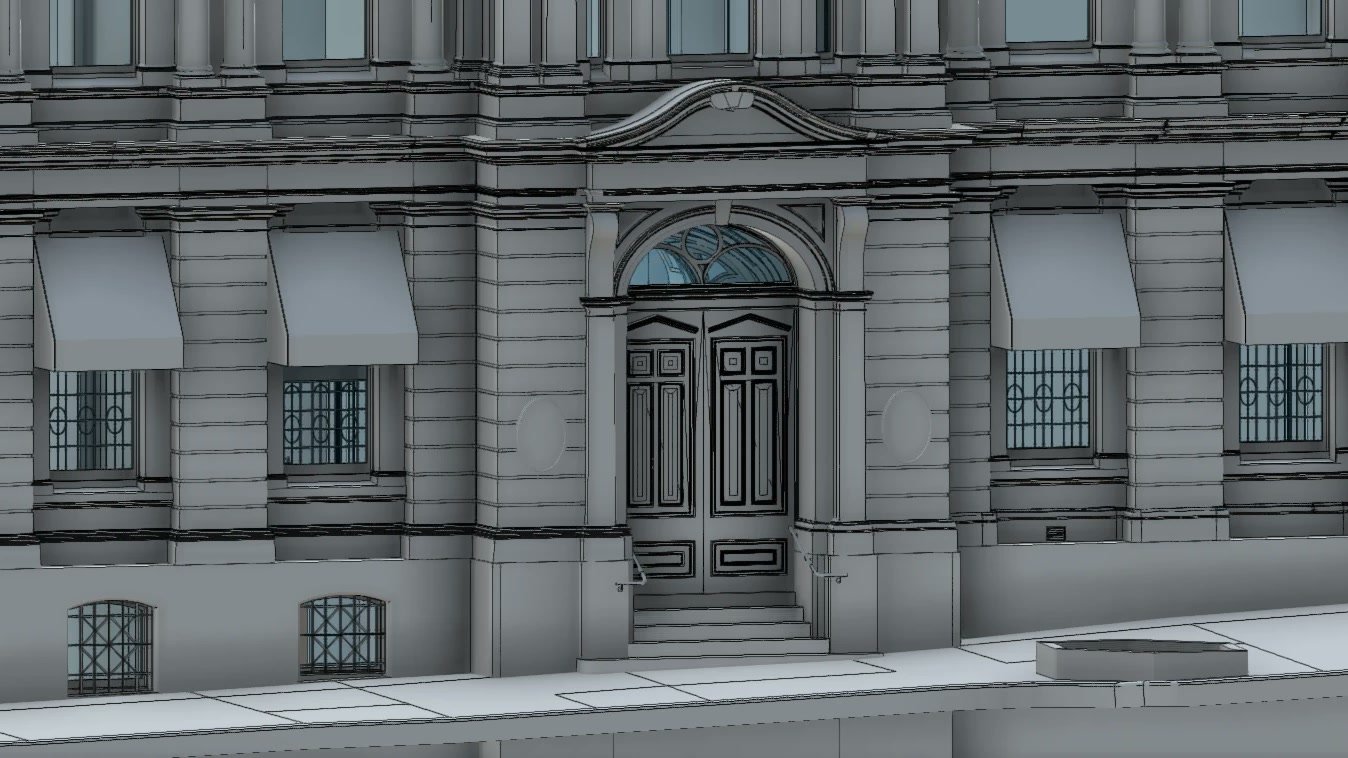
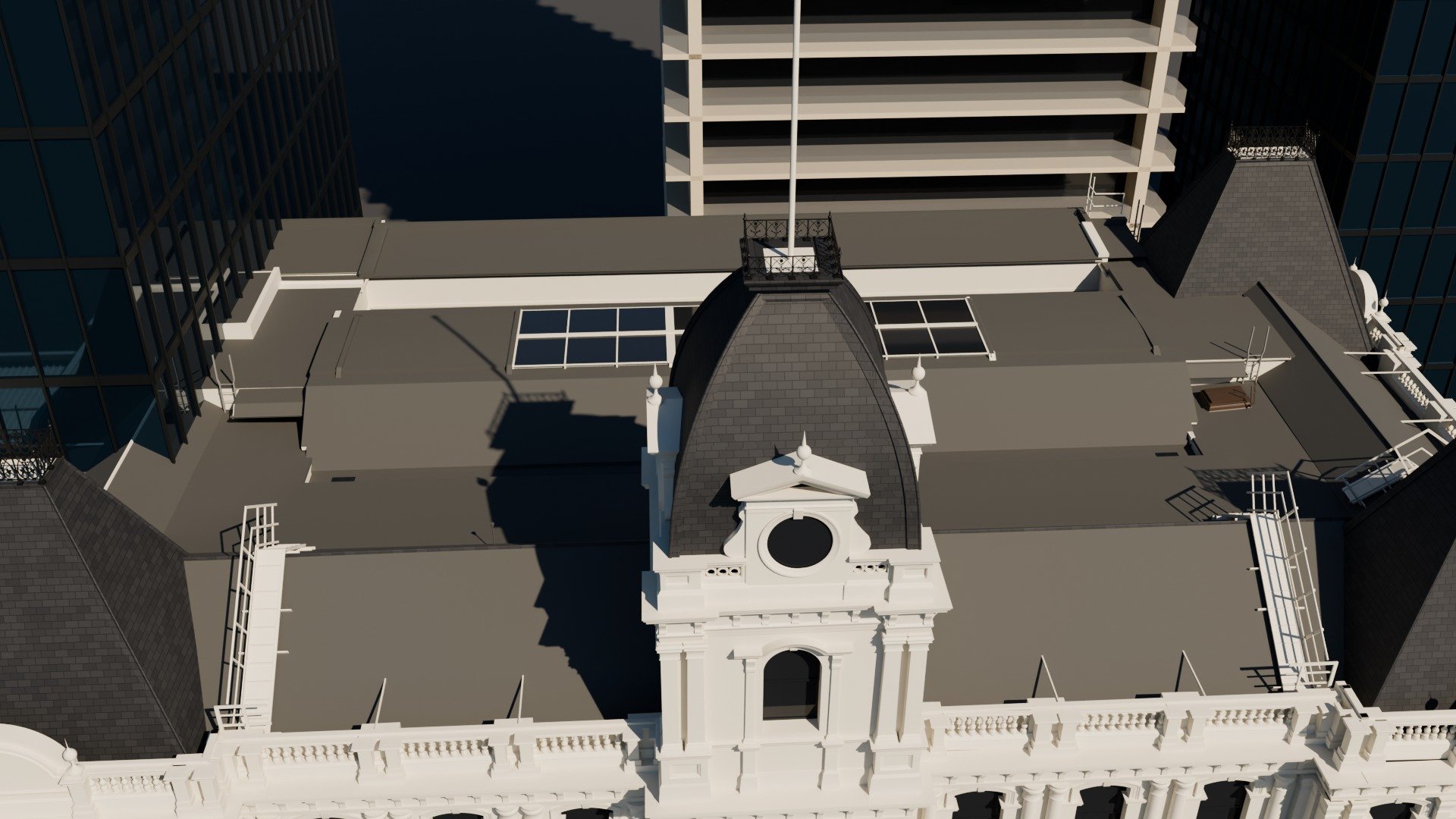
From the point cloud, Recon's modelling team built a full LOD 300 Revit model (Revit 2025) of the building, covering the interior, façades and roof. The model includes walls, doors and windows with their mullions, visible columns, beams and steel, floors, roof, stairs, handrails and ramps, joinery, and fixed fittings such as kitchens, basins and toilets, plus gutters, downpipes and site features.
Because the model is built directly from the scan, it records the building as it really is – including any out-of-square walls, varying floor levels and heritage detailing that never appear on old drawings.
From the model, Recon extracted a full set of 2D CAD drawings, supplied in both DWG (for designers working in AutoCAD) and PDF (for anyone to view and print).
The model was also exported to IFC, so it can be opened in other BIM software and shared across the wider design team.
“We’ve mainly used the Revit model for design. We’ve shared it with several architects and designers we work with, and they’ve all commented on the level of detail Recon captured and how much easier it made their design work. The 2D drawings have also been useful in putting several maintenance jobs out to tender.”
“We used to work from old drawings with limited information. Having both the Revit model and the 2D drawings gives our designers a much better starting point, which has saved them time and reduced our design costs. That was one of our main reasons for commissioning the model, and the feedback from our designers has reinforced that decision.”
Going Forward
The point cloud, Scene2Go walk-through and Revit model give Meka Management a lasting digital record of Customs House. Future fit-outs, maintenance planning and heritage work can all start from accurate, coordinated data and because everything is tied to the LINZ network any future survey or scan will line up with it.
“We expect to keep using the model for maintenance planning, future design work, and building consent applications. Having an accurate record that we can return to as projects come up is why we’re planning to scan the other buildings in our portfolio.”
Key Insights
Survey-accurate from the start: Survey control tied to the LINZ network put the scan, Revit model and topographic survey in one coordinate system, ready to line up with boundaries, council data and future surveys.
High-accuracy capture: Two FARO 3D laser scanners captured the heritage building inside and out, roof included, in about four days, with point-to-point relative accuracy better than 2 mm.
Scan-to-BIM in Revit: A full LOD 300 Revit model records the building as it really stands, not as old drawings say it should be.
Ready-to-use drawings: Floor plans, elevations and sections were extracted directly from the model and supplied as DWG and PDF, keeping 2D and 3D consistent.
Easy access for the whole team: The Scene2Go walk-through and IFC export let owners, designers and contractors explore and measure the building without specialist software or a site visit.
Minimal disruption: With most of the building vacant, Recon had access to the whole building and worked around the owner’s schedule and a tenant’s security requirements.
“We approached three providers, and Recon stood out for how patiently and thoroughly they answered my questions from the first enquiry. They exceeded our expectations on delivery, and they’re still happy to help when I call with a question. I’d readily recommend them.”
Peter Venter, Facilities & Project Manager, Meka Management
Enquiries to Recon can be made through our freephone 0800 732 669 or email info@recon.nz.