
High-Accuracy 3D Modelling of Great South Rd Bridge, Auckland
Summary
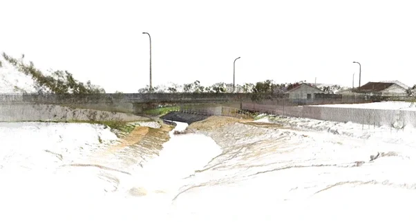
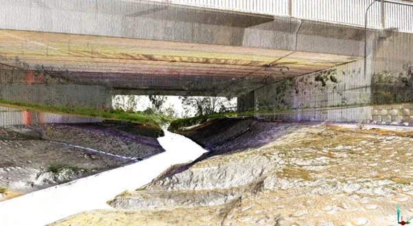
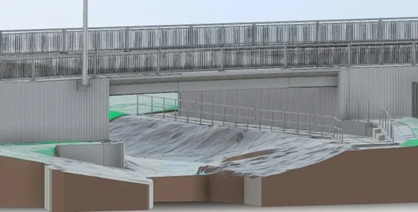
As part of Te Puhinui Regeneration Strategy, Auckland Council and Auckland Urban Development Office (AUDO) required precise spatial data beneath the Great South Road underpass to support pathway design in a highly constrained environment. Recon’s 3D scanning provided detailed as-built information that improved design accuracy, stakeholder communication and confidence in the survey data.
Te Puhinui Regeneration Strategy
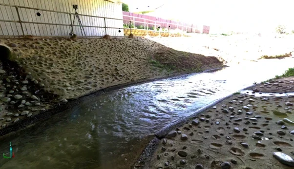
Te Puhinui regeneration strategy is a regeneration programme in the heart of South Auckland, focusing on the ancestral stream of Te Puhinui. Physical works to improve the natural environment, amenity, accessibility and health of the stream are underway. They include new wetlands, cycleways, stream naturalisation and significant native planting.
Part of the project involves upgrading the Great South Road underpass - a key scope of work involving Oliver Ferrick, Project Engineer at Glasgow Contractors. “The stream is really the focal point of the project, and it passes underneath Great South Road, but to really integrate these shared path features we needed to know the exact dimensions of what's going on under Great South Road”.
“The idea was if we can accurately map underneath Great South Road then the designers can find a solution that fits the stream, the watercourse and the bike path without impacting the structure or usability. It's really constrained through there and we want our footpath to be high enough that it doesn't flood all the time, but low enough that cyclists don't hit their head on the bridge. So, we're talking about getting things really accurate here, no guesswork because it's really tight! The client, Auckland Council, wanted a super accurate model which they could pass on to the designers.” Oliver continued.
Data Rich Capture
Oliver highlighted that from a communication standpoint creating a 3D model provides a visual representation that is far easier for non-technical audiences to understand. Traditional survey data, contour maps and 2D CAD drawings can be difficult for many people to interpret, especially those without an engineering background. In contrast, a 3D model closely resembles what people see in the real world. This makes it an extremely effective tool for communicating with stakeholders who may not be engineers. Instead of describing constraints abstractly you can visually demonstrate them: “Here’s what the site actually looks like - and here’s the challenge we’re dealing with.” That level of clarity allows someone living next door to understand the situation almost as easily as an engineer would.
Oliver goes on to say “quite often in the design space, a designer has a concept in mind, so they'll do a traditional survey thinking of what that design might be, and they don't pick up on all the extra data around it because they're just focused on those elements that are going to affect their design. The ability of having all the data so well mapped out is that you can fully restart the design process with new concepts and interrogate them without having to go back onto site. To get unlimited data-rich capture of what's there is super helpful.”
Another advantage of 3D scanning and modelling was the ability to quickly validate and interpret survey data with greater confidence. Oliver explained that with traditional survey data, anomalies can sometimes appear as isolated points that are difficult to verify:
“Occasionally you get survey data where there’s an anomaly, and you question it, why is that number like that? Then you go back and check photos to validate whether it’s correct. It might genuinely be accurate; for example, there could be a hole in the concrete wall that was surveyed. But when you’re only looking at discrete data points those anomalies really stand out and you can waste a lot of time checking them.”
In contrast, a 3D model provides the surrounding context for every data point. Rather than appearing as a single unexplained anomaly, variations become part of a visible pattern within the environment. As Oliver noted, seeing clusters of related points immediately reveals why the data differs, such as identifying a hole or recess in a wall, which helps build confidence in the accuracy and reliability of the survey data while reducing unnecessary verification work.
Going Forward
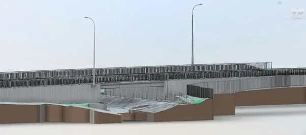
“I have seen the design for the bridge, and the Revit model has been the basis of all of their drawings for this section, so I can see they've got cross-sections cut through it and long sections cut through it and they've modelled the whole space in 3D now to get a design that they can really confidently deliver on.” Oliver
There is significant potential to expand the use of 3D scanning across Glasgow Contractors’ projects:
“I think there’s huge potential for 3D scanning across our work. We build streams and carry out earthworks, so one of the biggest opportunities is probably in claims and progress measurement. At the end of each month, we complete surveys to capture data that supports our claims. For example, with a stockpile you might walk around the base and over the top and estimate and then claim against that. Instead, you could capture a full scan every month that would provide a complete 3D model of the site, allowing you to calculate exactly what work was completed and make more accurate claims.
There’s also significant value in condition surveys. During a project, heavy machinery can cause vibration or settlement damage to nearby properties, if you had 3D scanning data from the beginning of the project, you could objectively compare conditions over time and clearly demonstrate whether those impacts were caused by the work.” Says Oliver
Key Insights
Recon’s 3D scanning provided highly accurate spatial data beneath the Great South Road underpass, enabling confident design decisions in a tightly constrained environment.
Pointcloud scans from commercial-grade 3D scanners achieve point-to-point (relative) accuracy of better than 5mm.
The detailed 3D model helped designers balance critical requirements such as flood protection, cyclist clearance and structural limitations without relying on guesswork.
Data-rich capture preserved comprehensive site information, allowing new design concepts to be explored and validated without returning to site.
Realistic 3D visualisation improved communication with stakeholders and non-technical audiences by clearly showing real-world site constraints.
The contextual nature of the 3D model increased confidence in survey accuracy, making anomalies easier to interpret and reducing time spent on verification.
“Jeremy presented to me about 10 years ago when Recon was just starting. He’s always answered the phone and has been great to work with, so highly recommend.” Says Oliver
Enquiries to Recon can be made through our freephone 0800 732 669 or email info@recon.nz.