
LiDAR
LiDAR drone technology has revolutionised the way aerial mapping and surveying are conducted, especially when combined with the capabilities of unmanned aerial vehicles (UAVs). LiDAR drone services offer a powerful solution for gathering high-resolution data over large areas in a short amount of time.
LiDAR scanning, is a remote sensing technology that uses laser pulses to measure distances and create high-resolution 3D maps of objects and environments. LiDAR systems emit laser beams towards a target and measure the time it takes for the beam to bounce back, creating precise distance measurements.
The benefits of drone LiDAR services include rapid data acquisition, allowing for efficient collection of large-scale data over expansive areas. This saves valuable time and resources compared to traditional surveying methods.
Drone LiDAR scanners are versatile and cater to a wide range of industries including surveying construction sites, monitoring vegetation health, assessing forestry, conducting environmental monitoring, or inspecting infrastructure.
-
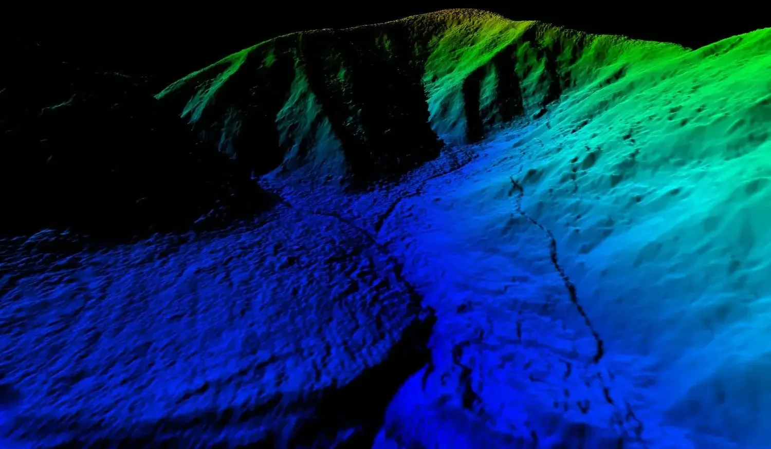
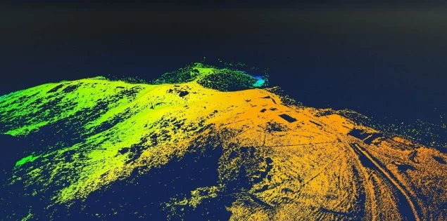
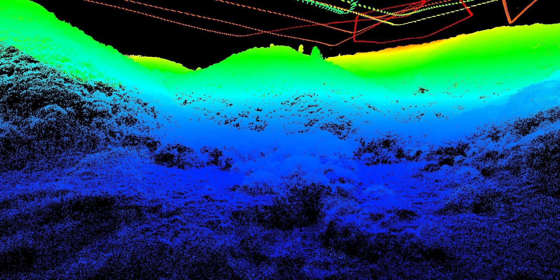
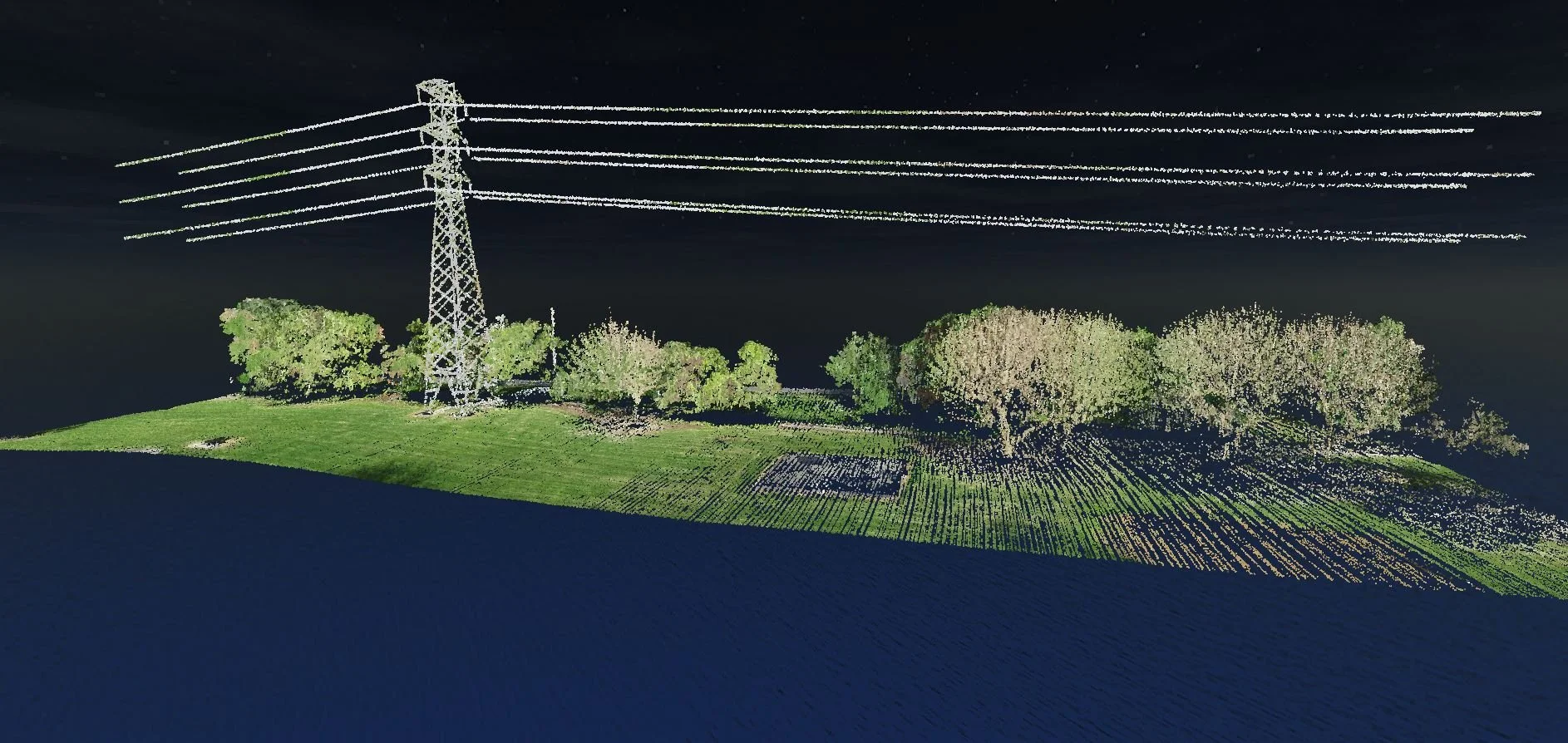
Drone LiDAR surveys result in high density, colourised pointclouds accurate to up to +/- 50mm
-
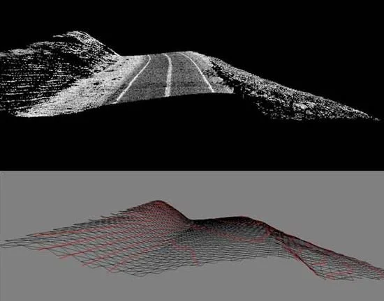
LiDAR points classified as ground are used to generate the digital terrain model, also known as ‘bare-earth’
-
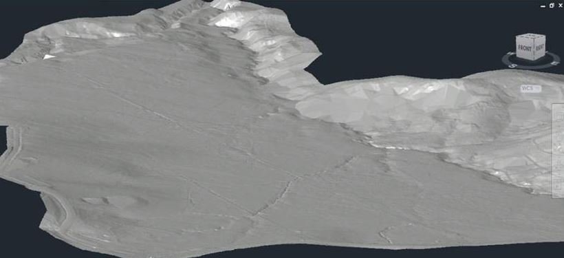
A TIN or surface derived from the LiDAR classified ground points
-
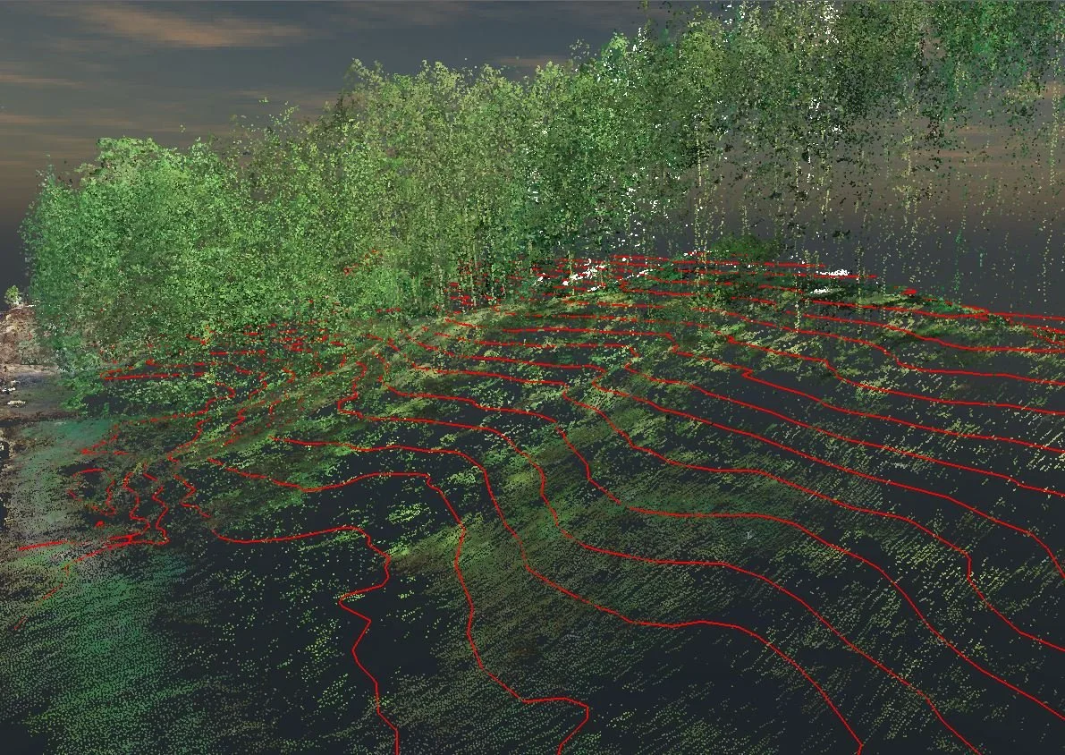
A TIN or surface created from all or a selection of LiDAR points, for example a surface representing a vegetation canopy
-
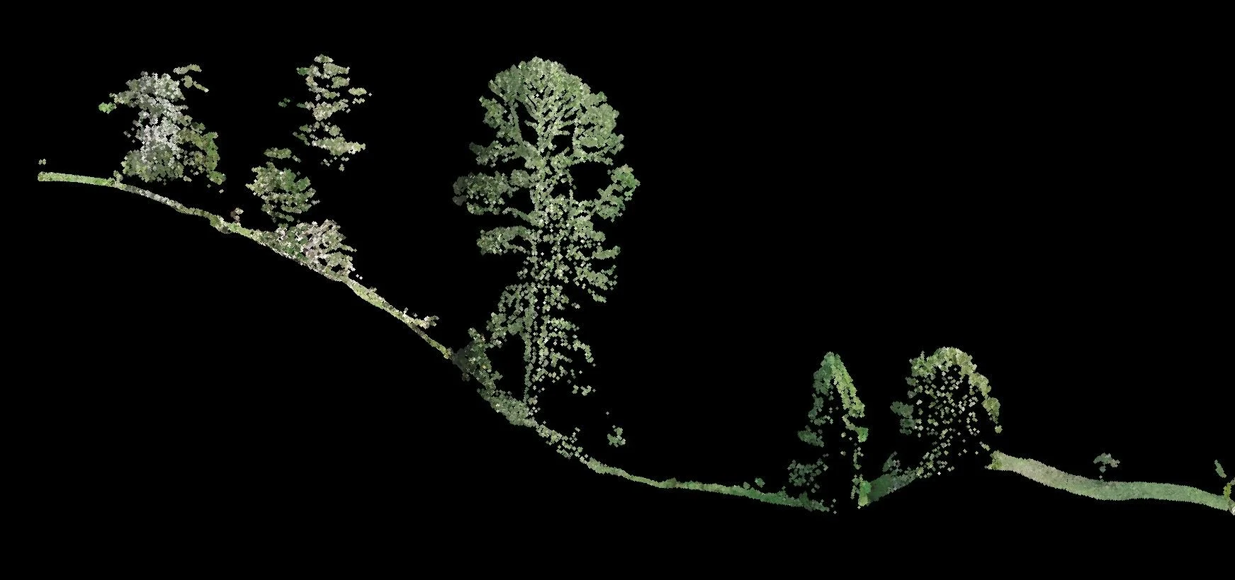
The LiDAR pointcloud can be classified into classes such as power poles, conductors, buildings, high and low vegetation which allows easier manipulation and analysis
-
2D and 3D datasets captured from the LiDAR pointcloud, such as breaklines, vegetation driplines, building outlines can be further utilised in 2D or 3D software, including GIS
Industries
-
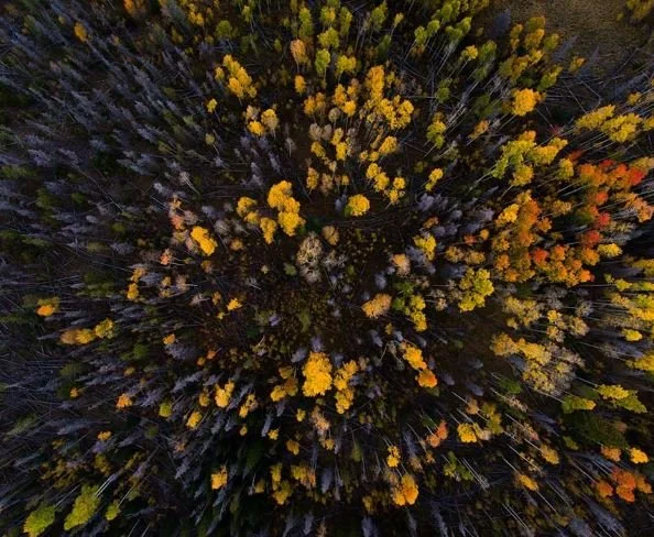
Agriculture & Forestry
High resolution RGB orthophotography for asset management and harvest planning
DTM for harvest road and haul planning
Biomass calculation
Repeat surveys for monitoring vegetation growth
-
Environmental
Project-specific flights covering complex landscapes
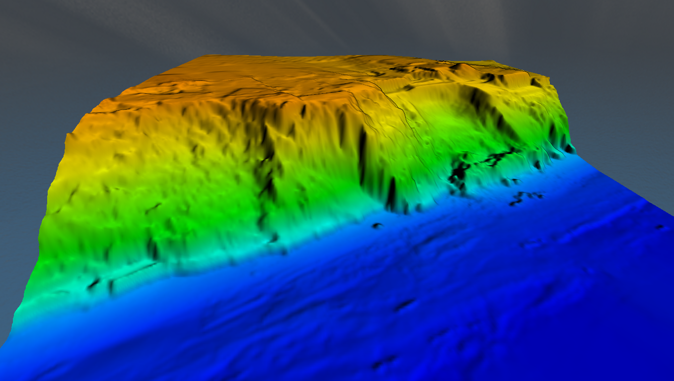
Model underlying geomorphology
Pointcloud or surface layers provided in CAD or GIS formats
Unobtrusive data gathering for sensitive projects
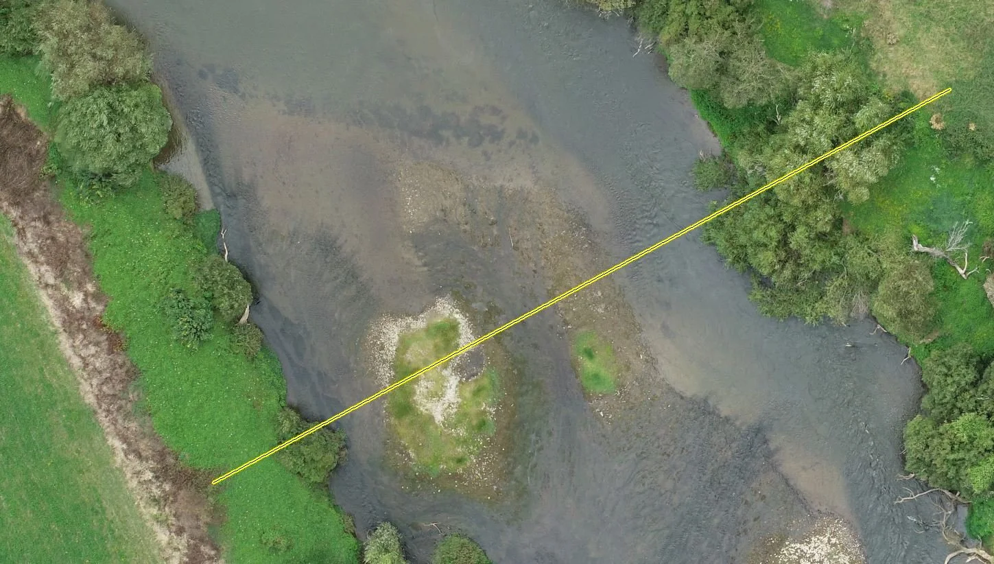
River-edge and stream-edge mapping
Coastal mapping, erosion monitoring, cliff-face mapping
Flood modelling
Tsunami modelling
-

Land Development
Ground contours or DTM
Engineering design with accurate data
3D visualisation
Hydro modelling
Start the project with the best data from the outset
-
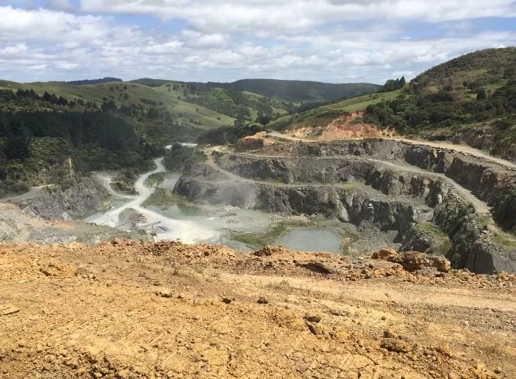
Mining
DTM or contours for mine exploration and design
Establish an accurate model over often tricky terrain
Rapid turn-around of data
Safer and faster than ground surveying
More cost-effective than field survey and more accurate than photogrammetry
-
Power and Utilities
Power conductor, assets and pipeline aerial survey via drone LiDAR
Accompanying high resolution aerial imagery
Hydro or large-plant asset management
Ground, vegetation and pole height data for thermal upgrade/re-tensioning design
Mapping vegetation, modelling growth through repeat surveys
As-built surveys
-
Transport
Aids new route design for road and rail
Captures a DTM of a wider corridor, enabling a more comprehensive design
Supplements ground survey and accurate enough for detailed design
Captures buildings and structures critical for initial planning
Ideal for access track for forestry
Mapping roadside slips and monitoring change
Case Studies
-

DRONE LIDAR SURVEY AIDS TE RERE HAU WINDFARM UPGRADE
Recon was approached by surveying and engineering professionals Aurecon in early 2022 to provide LiDAR aerial mapping services for NZ Windfarms Limited’s Te Rere Hau wind farm repowering project located on the Tararua Ranges.
Having worked together previously, Aurecon was familiar with the benefits Recon’s drone LiDAR services offer with the rapid capture of highly detailed and accurate topographic data.
-
UAV LIDAR MAPPING FOR KIWIRAIL
In September 2019 the NZ Government announced funding to rejuvenate the Northland rail line between Swanson, in West Auckland, and Whangarei. Along this very scenic route are 13 tunnels constructed up to a century ago that enable the rail service to traverse through some challenging landscape. Upgrading these tunnels, which includes lowering the rail to ensure larger shipping containers have sufficient clearance, involves significant geotechnical and structural engineering input.
Drone LiDAR advantages over other remote sensing and mapping technologies:
High accuracy
Accurate measurements of the terrain, objects, and features in the environment. This makes it a valuable tool for applications such as mapping, surveying, and monitoring.
Wide coverage
Covers large areas quickly and efficiently, making it useful for applications such as land management, forestry, and disaster response.
Safety
A non-invasive technology that does not require physical contact with the environment, making it a safe tool for use in hazardous or sensitive areas.
High resolution
Detailed 3D maps of the environment, with high spatial resolution. This enables users to see fine details, such as the shapes of individual trees or buildings.
Versatility
LiDAR can be used in a variety of settings and environments, including urban areas, forests, and bodies of water.
Contact Us for Drone LiDAR services in Auckland & NZ Wide
Location
Auckland & NZ
Phone
0800 732 669
Email
info@recon.nz