
PhotoMesh
PhotoMesh – Fully automated, scalable photogrammetry
High-performance 3D reconstruction that transforms photos into quality, 2D and 3D geospatial data
Combining photos in a wide range of formats, PhotoMesh generates highly-detailed 3D meshes, orthophotos, point clouds, elevation models, and more. PhotoMesh’s breakthrough 2D and 3D mapping technology is based on the highest-performance photogrammetry, computer vision, and computational geometry algorithms.
PhotoMesh employs elaborate tiling mechanisms to efficiently handle projects of any size, even large projects with hundreds of thousands of photos. Running on standard hardware, PhotoMesh can also exploit computer clusters and cloud computing to vastly accelerate the build by running a single project simultaneously on hundreds of fuser machines.
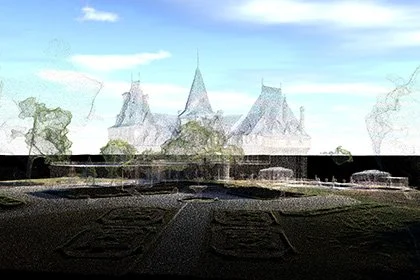
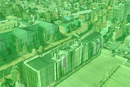
3D Mapping
Transform aerial and ground photos and LiDAR collections into city-scale, digital twin models with advanced color balancing and high-quality texturing, in a range of 3D mesh and point cloud formats. With its survey-grade, geo-referencing accuracy, PhotoMesh can be used for urban planning, infrastructure and engineering project management, inspection and 3D GIS applications.
Digital Twin
PhotoMesh supports close-range photogrammetry, producing point cloud and mesh models with sub-millimeter accuracy. These models can be leveraged to perform virtual industrial inspection and asset management that remove the risk of human error, at a fraction of the time and cost of on-site, traditional inspection methods. PhotoMesh’s range of 3D outputs can also be enablers of customised AI and machine learning analysis tools.
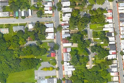
2D Mapping
Fully automated, high quality generation of multispectral true-orthophotos, Digital Surface Models (DSM) and Digital Terrain Models (DTM). PhotoMesh 2D mapping outputs can be used in a broad range of industries, including agriculture and urban mapping, as well as serve as enablers of customised AI-powered analysis tools.

Range of supported output formats ensures maximum interoperability with other 2D/3D GIS solutions

3D Mesh
Point Cloud
Orthophoto
Digital Surface Model (DSM)
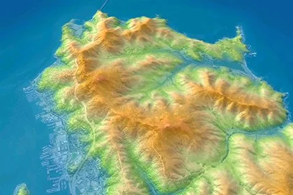
Digital Terrain/Elevation Model (DTM/DEM)