
TerraBuilder
High-performance terrain database creator
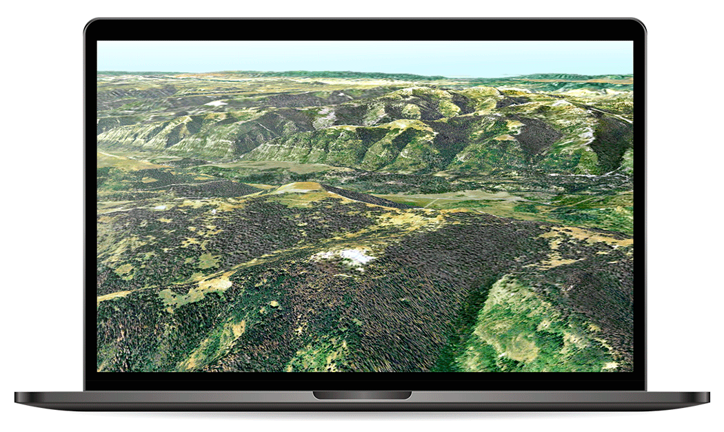
TerraBuilder provides professional-grade tools for manipulating and merging aerial photos, satellite images, and digital elevation models of different sizes and resolutions. The resulting photo-realistic, geographically accurate terrain database can be made available to local TerraExplorer clients or published directly from TerraBuilder to SkylineGlobe Server for serving to remote TerraExplorer and WMS/WMTS clients.
Load
Load imagery and elevation layers in a wide range of data formats. TerraBuilder uses multi-core and multi-computer processing to support massive data set publishing while maintaining high performance.
Manipulated
Powerful tools to crop, adjust, replace, resize, and reposition your photos, images, and digital elevation model to ensure maximum precision in the 3D terrain database result.
Create
Merge all adjusted layers into a geographically accurate, multi-resolution terrain database. For projects whose source data is constantly being updated or modified, optimised imagery and elevation formats can be generated for use by the on-the-fly, server-side terrain generator.
Interoperability
TerraBuilder’s extensive plugin support allows you to load your data in the file format or database/server you need. Numerous formats and databases are supported including the following:
Files:
Tiff (.tif, .itiff)
Erds Imagine (.img)
MrSID (.sid)
ER-Mapper JPEG2000 (.jp2, .j2k, .jpc)
Oracle Spatial Database
ECW Image Web Server
ArcSDE Raster Server (.sde)
Databases and servers:
Oracle Spatial Database
ECW Image Web Server
ArcSDE Raster Server (.sde)
Robust Tools for Manipulating Your Data
TerraBuilder provides a range of editing tools with which to manipulate the imported raster files, enabling maximum precision in the 3D terrain database result. Possible manipulations include cropping, resizing, moving, feathering, adjustment of geographic coordinates using tie points and modification of color and elevation parameters.

Scalability and Elasticity
Share the workload of massive 3D database creation between several computers and processors on your local network. The master computer utilises the computing power of the network’s client computers for creating your terrain and for generating optimised imagery and elevation formats to be used by the on-the-fly, server-side terrain generator.