
Drone LiDAR Survey Aids Te Rere Hau Windfarm Upgrade

Recon was approached by surveying and engineering professionals Aurecon in early 2022 to provide LiDAR aerial mapping services for NZ Windfarms Limited’s Te Rere Hau wind farm repowering project located on the Tararua Ranges.
Having worked together previously, Aurecon was familiar with the benefits Recon’s drone LiDAR services offer with the rapid capture of highly detailed and accurate topographic data.
The project involves repowering the existing windfarm by removing the 92 existing two-blade, 47-metre high turbines and installing up to 30, three-blade, 162-metre high turbines to improve the overall power generation and efficiency at the site.
The project was accepted for referral to an expert consenting panel under the Covid 19 Recovery (Fast-track) Consenting Act 2020This was on the basis that the repowered wind farm is expected to improve economic, employment and environmental outcomes, create significant employment opportunities, and contribute to New Zealand’s efforts in mitigating climate change. NZ Windfarms consent application is currently with the expert consenting panel for consideration
The significantly larger turbines required the development of the existing internal access roads to support the delivery and erection of components. Where possible, the existing road corridors were retained and enhanced to reduce the overall effects of the proposed development. Confidence in solutions was supported by high quality survey data over part of the site, however parts of the site data quality was relatively coarse which was not ideal for consenting design.
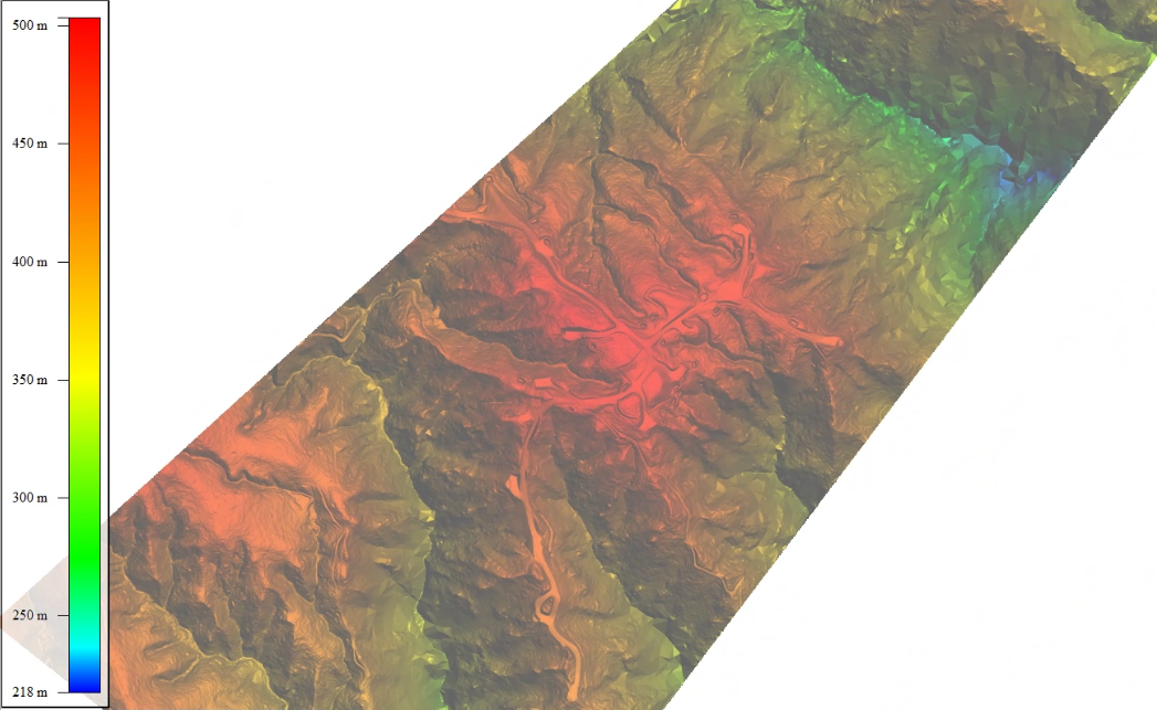
Alongside with a LiDAR survey of the windfarm area where existing ground resolution was coarse, Recon were asked to capture accurate data of the existing haul road to enable Aurecon’s engineers to determine what modifications might be required (if any) to transport the turbine towers and blades to the site. Recon conducted a winding linear flight with LiDAR and high resolution aerial photography to achieve these outcomes. Together the data provided greater certainty on the effects of the proposed development with respect to earthworks and ecology for the fast-track consent.
The main challenge faced by the survey team was misty conditions on the ranges which delayed the start time until 11am. New Zealand aviation rules require drones to be operated with clear line of sight on the drone at all times. Once the site cleared the team got underway and flew their pre-programmed flight with no further delays.
Data processing over the windfarm took a little under two weeks from capture and the haul road processing followed on after that. The project was completed successfully with all data supplied in terms with existing survey data.
Enquiries to Recon can be made through our freephone 0800 732 669 or email info@recon.nz.