
UAV LiDAR Mapping for Kiwirail
Drone LiDAR Assists Northland Rail Upgrade
In September 2019 the NZ Government announced funding to rejuvenate the Northland rail line between Swanson, in West Auckland, and Whangarei. Along this very scenic route are 13 tunnels constructed up to a century ago that enable the rail service to traverse through some challenging landscape. Upgrading these tunnels, which includes lowering the rail to ensure larger shipping containers have sufficient clearance, involves significant geotechnical and structural engineering input. For this project KiwiRail engaged consultants Tonkin and Taylor to coordinate and supervise geotechnical investigations within the tunnels and design of the lowering works.
Recon, an Auckland-based drone survey company, was subcontracted to capture accurate topographic information encompassing a wider area around the tunnel portals and above the tunnels themselves. Due to the often dense vegetation cover LiDAR was deemed critical in gathering the required ground data and in the days before and after New Zealand’s first Covid-19 lockdown the Recon crew completed the capture of all 13 tunnels under some extremely tight timeframes.
A short time later the project engineers were making use of multiple forms of the 3D data as well as the high resolution aerial photography that was flown concurrently. Tonkin and Taylor’s Mark Child helped manage the acquisition process and comments “Recon did a great job diving into the project and delivering the LiDAR and aerial imagery within a very compressed timeframe. Their flexibility and willingness to get the job done amongst challenging circumstances were standout attributes so far as the investigation team were concerned. The information provided by Recon was of a high quality and was used seamlessly by the designers that followed.”
Recon’s Managing Director Jeremy Neilson adds “this project was certainly not without its challenges, the landscape was very undulating and access to the remote sites was all via hi-rail. But it was one of those projects that you get a real kick out of on completion. Knowing the data we’re getting from the system is great quality has really assured us that we’re only scratching the surface as to what projects our LiDAR can be deployed on.”
The tunnel interiors had been mobile laser scanned and the entrances surveyed so the LiDAR capture provided a wider area perspective, integrating near-seamlessly with the existing data.
How is LiDAR different to photogrammetry?
LiDAR works by emitting active light pulses from the sensor which reflect back and measurement data is captured. Photogrammetry by contrast works almost in reverse as it triangulates pixel coordinates from overlapping photos to ‘reverse engineer’ the land cover. While ideal for modelling open construction sites, mines and built environments it doesn’t allow for capturing the ground below grass, scrub or bush.
What difference is there between UAV LiDAR and a standard drone survey?
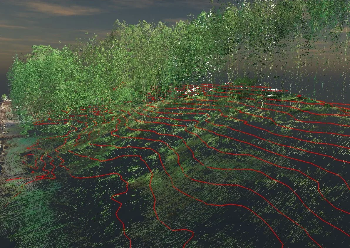
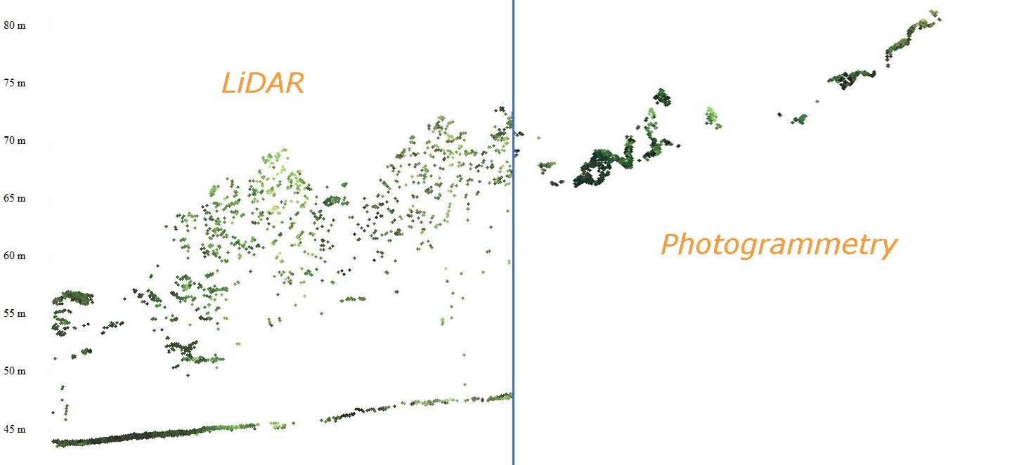
The attached image presents a comparison between the UAV LiDAR and photogrammetry flown over the same section of forest showing how the LiDAR has achieved thousands of reliable ground strikes from which a detailed terrain model has been formed. The banner image above shows the resulting contours. The reason using a UAV has proven so effective is the sheer number of LiDAR points that are emitted from the scanner at low altitude.
Feel free to email info@recon.nz or call 08000 732669 to discuss your requirements.