
Laser Scanning A Lava Cave Provides New Subterranean Data Sets
With Auckland’s volcanic field under World Heritage Site application, and many lava caves ancient homes to potentially important archaeological and cultural remains, engineering geologists such as GHD’s Matt Boyd, need to ensure any such underground environment is thoroughly examined in accordance with council guidelines and legislative requirements.
“There is a new provision under the Auckland Unitary Plan which is designed to protect significant natural features, in this case lava caves greater than 1.0m in any dimension,” Matt says.
“Items such as moa bones and fossilised bird remains have been discovered in lava caves beneath Auckland, and some have been found to be significant burial sites for local iwi, so we have to be very careful about assessing and protecting them when they’re discovered.”
Recently, Matt and his geotechnical construction team from GHD – which has been working with Watercare on the current phase of its Hunua 4 pipeline project – discovered a subterranean lava cave 1.4m below a concrete suburban driveway. From the point of entry, the cave was deemed of significant size; 26m in one direction and 16m in the other, with a maximum height of 2.2m. The Hunua No 4 project is one of Watercare’s most important projects and is a 31km pipeline of 2.0m diameter and 1.6m diameter and due to its size and strategic importance to Auckland’s Water Supply, it was vital to develop the right engineering solution for crossing the lava cave.
“As soon as a cave is discovered, we are required to halt work 20m either side of it. In this instance, we decided that the best way to get an accurate picture of what was below us was to utilise a laser scanner, which is where Jeremy Neilson and Recon came in,” Matt says.
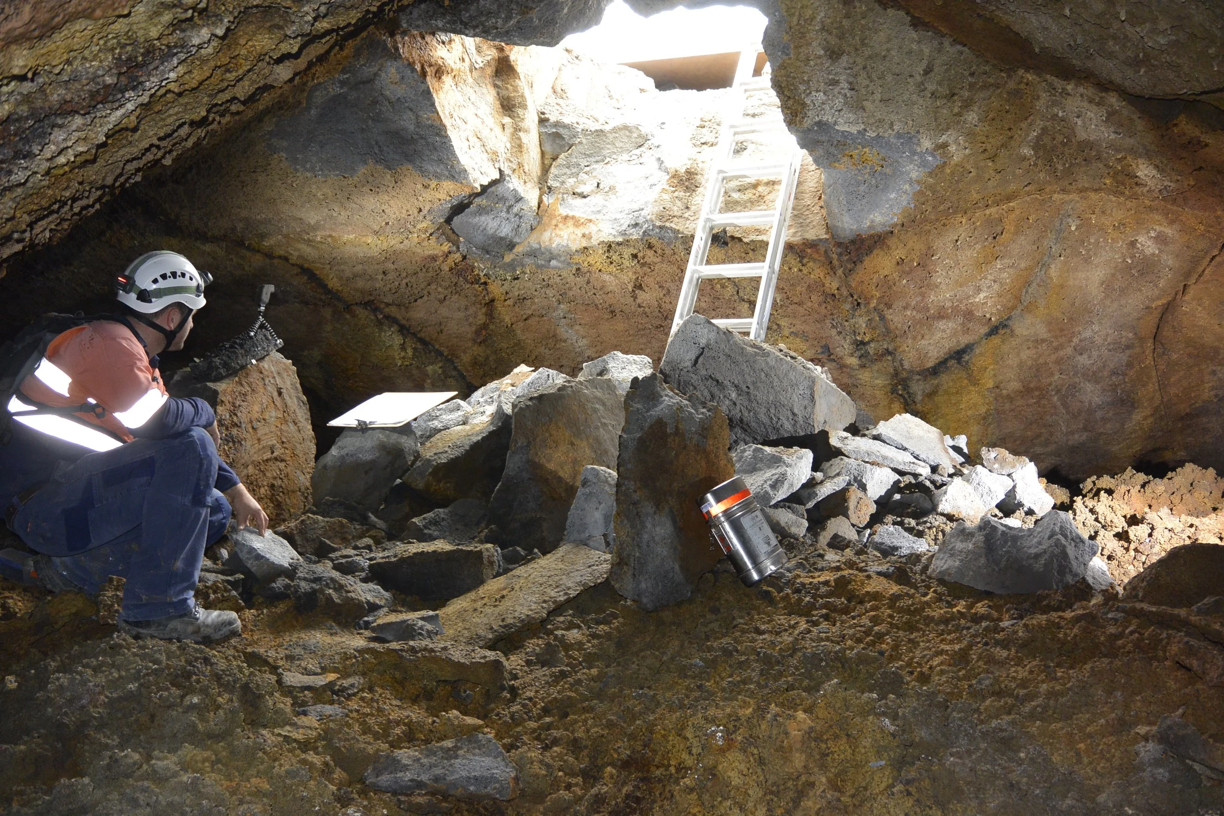
“It’s one of the first times we have deployed a portable laser scanner to record this type of feature. And because of the technology Recon uses, we were able to scan the buildings and landscape features on the surface, as well as the cave beneath.”
“This was significant because it allowed us to tie the cave’s dimensions back to its environment; we weren’t looking at the scan and overlaying it onto topographical information. Rather, we had a detailed model of the entire site to work with.”
Matt says that lava caves are usually surveyed by compass and bearing, so the technology Recon is using really progresses the game for GHD in such circumstances. Once scans were complete, Jeremy was able to provide detailed pointcloud data from the site, meaning Matt’s team could design an engineering solution for the Watercare infrastructure through the cave with much more spatial clarity and meeting the Auckland Council Requirements for future protection.
“Jeremy from Recon was great to work with on this project,” Matt continues.
“It’s good to have an outsource team that bring excellent ideas and world-leading laser scanning technology to the table. As with any urban construction project of this nature, we are aware of the impacts on the community, so time is always of the essence, especially when encountering a situation like this.
“Recon, along with the Natural Heritage Unit within Auckland Council, helped us move on as quickly as possible, with the best possible data from which to decide on an engineering solution.”
Matt also says that all subterranean scanning work was carried out professionally by Recon, under Watercare safety standards and the confined space workplace requirements of WorkSafe best practice guidelines.