
3D Laser Scanning Helping to Future-Proof the Past
Recon recently worked with archifact – architecture & conservation limited (archifact), on the survey and scan programme of a heritage building for the purposes of compiling highly accurate plans for earthquake strengthening.
Archifact first utilised leading-edge laser scanning technology back in 2005. Senior Associate, Andy O’Neil, says that the intervening decade has seen the quality of data drawn from the process increase exponentially in quality.
“The collaboration between archifact and Recon has produced highly successful results in the built heritage context,” he says.
“The use of high-definition 3D digital surveys of heritage assets establishes an accurate archive for future heritage management, and records not only the buildings, but also their important environmental and topographical contexts.”
With an increased legislative focus on earthquake strengthening of heritage buildings, Recon’s ability to scan built environments in an extremely detailed way means consultative entities such as archifact are able to provide an accurate picture of any given structure or environment in order to better inform the decision-making process around remediation or strengthening work.
“It’s also good practice that in heritage conservation, archival records of a site are collected for posterity,” Andy continues.
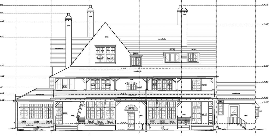
“These records are used to inform the planning and implementation of conservation practice, providing accurate base-line data upon which conservation interventions can be designed and specifications drawn up.
“Such a baseline as-built survey can be used to monitor the effects of current and future conservation works, and provides a 3D digital model over which a broad range of cross-disciplinary perspectives can be applied for modelling the seismic resilience of a structure, or the effects of non-biological and biological factors of change to the building fabric.”
Andy says that another benefit of working with the sort of high-resolution 3D digital data that Recon captures using laser scanning hardware, is that the resultant imagery can be used for remote interpretation by any number of stakeholders.
With the impracticalities of having large numbers of people moving through historically sensitive or structurally fragile physical environments in mind, Recon’s data allows Andy and his fellow consultants to provide an accurate picture of a surveyed area, without necessarily having to have all connected parties on-site.
Increasingly, data used in this way isn’t just for the benefit of council inspectorates either. Where the general public is invited to engage with the past, Recon’s 3D survey data can also be used to educate.
“We can use the data to develop accurate 3D models for remote interpretation, affording opportunity for the ‘virtual visitor’ and a wider outreach for historic heritage for the public benefit, particularly in places whose fragility means that general public access is impractical,” he says.
“The information and data gathered through the accurate survey of an environment provides an important record of the imperfections, the spirit, of a historic heritage place, so informed and appropriate responses to its values and conservation can be made.”